North America Map: Complete Guide to Countries, Geography & Downloads
North America spans more than 24 million square kilometers across the northern portion of the Western Hemisphere. From the frozen Arctic coastlines of Canada to the tropical shores of Central American neighbors, the continent encompasses extraordinary geographic diversity. This guide examines the countries, physical features, and map types that define this vast region.
Maps of North America serve educational, navigational, and reference purposes across countless contexts. Whether identifying sovereign states, locating major mountain ranges, or understanding regional boundaries, these cartographic tools provide essential visual representations of continental geography.
What Countries Are in North America?
The United Nations recognizes 23 sovereign states within North America, though geographic definitions vary depending on the source consulted. The continental core consists of three major nations, while numerous island territories and Caribbean states complete the regional picture.
Canada encompasses the greatest territorial extent, covering roughly 9.98 million square kilometers. The United States follows with approximately 9.83 million square kilometers, while Mexico accounts for 1.96 million square kilometers. These three nations form the political and geographic backbone of continental North America.
Mexico unquestionably belongs to North America, both geographically and politically. The country shares its northern border with the United States and lies within the continental landmass that geological surveys consistently classify as part of North America.
- Canada, the United States, and Mexico constitute the primary continental landmass
- Island nations including Cuba, Jamaica, and Haiti occupy the Caribbean Sea region
- Central American countries such as Costa Rica represent transitional zones
- Territorial definitions remain subject to scholarly and institutional variation
- The northernmost reaches extend into the Arctic Ocean
- Coastal boundaries include both Atlantic and Pacific Ocean frontiers
| Fact | Detail |
|---|---|
| Continental Position | Northern portion of the Americas |
| Ocean Borders | Atlantic, Pacific, and Arctic |
| Highest Elevation | Denali at 6,190 meters |
| Largest Water Body Shared | Great Lakes system |
| Major Mountain Range | Rocky Mountains |
| Regional Classification | UN Stats: 23 sovereign states |
What Does a Map of North America Look Like?
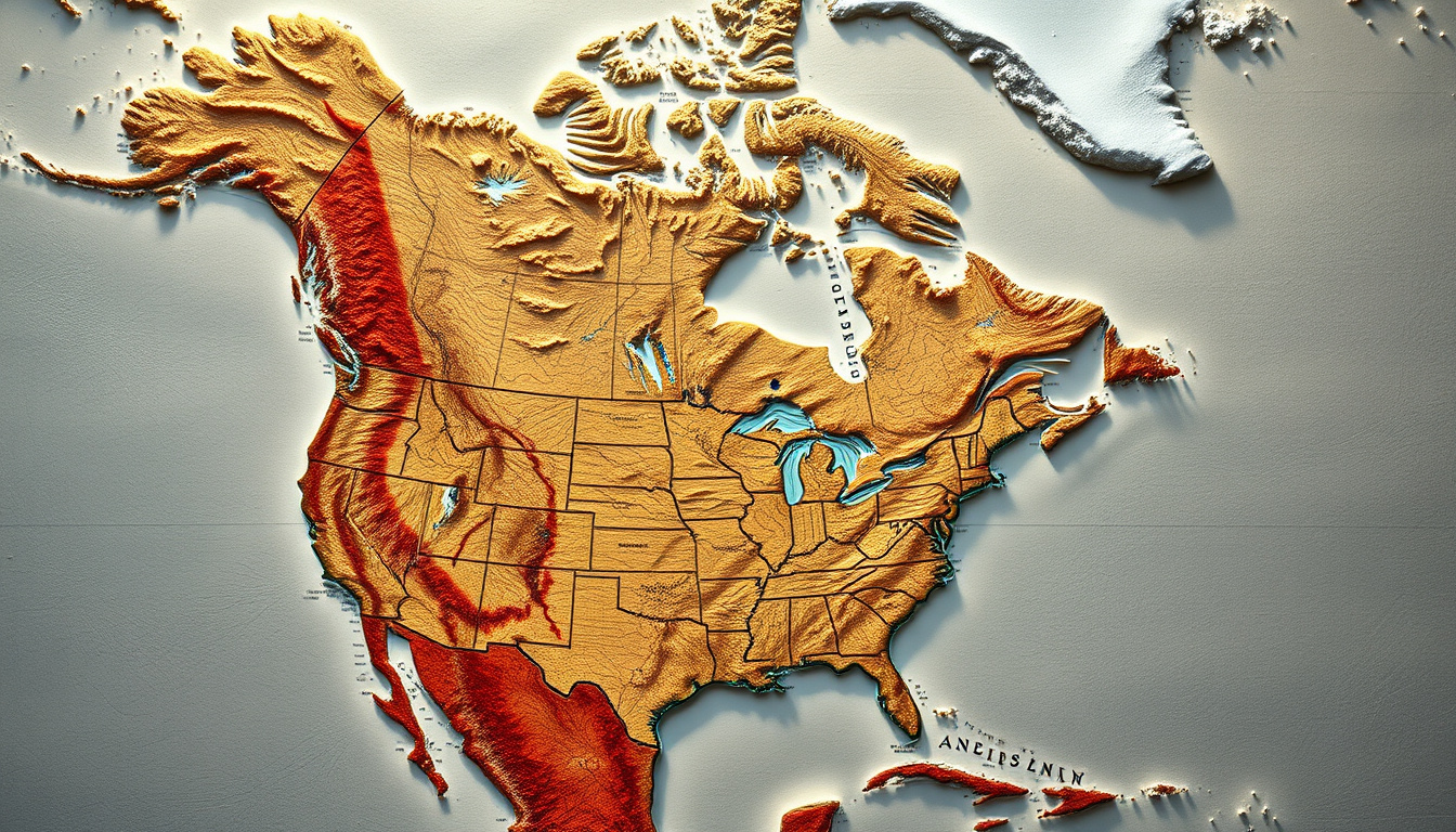
Viewing a map of North America reveals a distinctive triangular landmass oriented roughly north to south. The continent stretches from the Arctic regions of Canada and Greenland southward toward the Panama Canal, with the world’s longest coastline tracing its eastern and western margins.
Regional Positioning and Continental Placement
North America occupies the northern portion of the Western Hemisphere, positioned between the Atlantic Ocean to the east and the Pacific Ocean to the west. This strategic global position places the continent at the crossroads of major oceanic trade routes and climatic zones.
From a world map perspective, North America appears as one of seven continental divisions. The continent shares its hemispheric position with South America to the south, while the Arctic Ocean defines its northern boundary.
State and Provincial Boundaries
Maps displaying internal divisions reveal the complex political geography within North American nations. The United States comprises 50 states, while Canada divides its territory into 10 provinces and 3 territories. These subdivisions create intricate boundary patterns visible on detailed cartographic representations.
High-resolution political maps show provincial boundaries including Alberta, British Columbia, Ontario, and Quebec within Canada. American state boundaries appear with clear delineation from coast to coast.
What Are the Physical Features of North America?
Physical geography of North America encompasses dramatic topographical variation across its vast expanse. Mountain ranges, inland waterways, and coastal features shape regional landscapes and ecological systems throughout the continent.
Mountain Systems and Elevated Terrain
The Rocky Mountains constitute the most prominent mountain system, spanning more than 4,800 kilometers from northern Canada through the United States. These peaks formed through complex tectonic activity over millions of years, creating diverse alpine environments and watersheds.
Denali, located in Alaska, represents the continent’s highest point at 6,190 meters above sea level. This granite giant part of the Alaska Range demonstrates the significant geological elevation that characterizes North American landscapes.
Water Bodies and Drainage Systems
The Great Lakes system forms one of the world’s most extensive freshwater networks, containing approximately 21% of the globe’s surface fresh water. Lakes Superior, Michigan, Huron, Erie, and Ontario create natural boundaries between the United States and Canada while serving as critical transportation and economic corridors.
Additional significant water bodies include Hudson Bay in Canada, the Labrador Sea along the Atlantic coast, and Baffin Bay connecting to the Arctic Ocean. These marine features profoundly influence regional climates and indigenous communities throughout the northern territories.
The United States Geological Survey publishes detailed geological maps and physical feature documentation that cartographers and researchers reference for accurate topographical representation.
Types of North America Maps: Political, Blank, and Printable
Cartographic products serving North America fall into several distinct categories, each designed for specific purposes ranging from educational activities to navigational applications.
Political Maps
Political maps emphasize national and regional boundaries, displaying countries, states, provinces, and capital cities with clear visual distinction. These representations use color coding and labeling to distinguish between sovereign territories and administrative divisions.
Blank Outline Maps
Blank maps provide undecorated territorial outlines suitable for educational practice and assessment. Students and educators use these resources for geography exercises, blank map quizzes, and collaborative learning activities.
Printable and Downloadable Formats
Numerous educational institutions and mapping services offer free printable maps in PDF and JPEG formats. University cartographic collections and specialized geography websites provide high-resolution versions suitable for classroom display and individual study.
- Educational portals provide blank outline maps for geography practice
- Political maps showing country and state boundaries available as PDFs
- Labeled and unlabeled versions serve different learning purposes
- High-resolution formats suitable for printing from institutional sources
- Various map projections accommodate different display requirements
- Interactive digital versions increasingly complement traditional printed formats
Map projections such as Lambert Conformal Conic produce varying degrees of accuracy across different continental regions. Users should select projections appropriate for their specific analytical or educational needs.
North America Map with Capitals and Key Cities
Labeled maps featuring capitals and major urban centers provide essential reference information for understanding regional population distribution and political organization across the continent.
Capital Cities of Core Nations
Ottawa serves as Canada’s purpose-built capital city, selected in 1857 as a compromise between competing urban centers. Washington, D.C. functions as the capital of the United States, established as a federal district specifically designated for governmental purposes. Mexico City, originally built by indigenous civilizations before Spanish colonization, represents one of the world’s oldest continuously inhabited capital settlements.
Major Metropolitan Centers
Beyond national capitals, North America contains numerous metropolitan areas of significant population and economic influence. New York City, Los Angeles, Chicago, Toronto, and Montreal rank among the continent’s largest urban agglomerations, each contributing distinct cultural and economic characteristics to regional identity.
Historical Timeline of Continental Cartography
Understanding how cartographic representations of North America evolved provides valuable context for contemporary mapping practices and geographic education.
- – Indigenous peoples occupy continental territories with established territorial knowledge and navigation systems
- – European contact initiates sustained cartographic documentation of continental coastlines and interior regions
- – American Declaration of Independence establishes new political boundaries requiring updated cartographic representation
- – Louisiana Purchase doubles United States territory, necessitating extensive new survey work and mapping projects
- – Canadian Confederation creates formal national boundaries requiring modernized territorial documentation
- – Alaska boundaries formalized following purchase from Russia in 1867
- – Satellite technology and digital mapping enable unprecedented cartographic precision and accessibility
Established Information and Areas of Uncertainty
| Established Facts | Remains Uncertain |
|---|---|
| Three core continental nations: Canada, United States, Mexico | Precise definition of Central American vs North American classification for border nations |
| Total continental area: approximately 24.7 million km² | Population figures vary by counting methodology and territorial inclusion |
| Rocky Mountains as dominant mountain system | Ongoing debates regarding precise continental boundary delineation |
| Denali as highest continental point at 6,190 meters | Classification of disputed island territories within Caribbean regional groupings |
Geographic definitions vary between institutions. The United Nations Statistics Division recognizes 23 sovereign states within the region, while some sources include additional territories or exclude certain Caribbean nations based on alternative classification systems.
Geographic and Geological Context
North America formed through hundreds of millions of years of tectonic activity, with the continental core assembling from multiple ancient landmasses. The underlying geological structure influences contemporary topography, mineral resources, and natural hazard patterns throughout the region.
Climate zones within North America range from Arctic conditions in northern Canada and Greenland to tropical environments in southern Mexico and Caribbean island territories. This climatic diversity drives ecological variation and agricultural potential across continental regions.
Economic activity concentrates in established urban corridors including the Northeast United States and Southern Ontario, though resource extraction industries shape economic geography throughout less densely populated territories. Transportation networks connecting these economic centers rely heavily on the continental waterway systems and coastal port facilities.
Sources and Reference Materials
Geographic and cartographic information draws from established reference sources providing authoritative regional documentation.
“North America encompasses 23 sovereign states distributed across continental and island territories.” — United Nations Statistics Division
Reference works including the CIA World Factbook, Britannica encyclopedic entries, and National Geographic publications provide comprehensive regional documentation. The United Nations statistical methodology offers standardized regional classifications adopted by international organizations.
Educational institutions including the University of Texas and Texas State University maintain cartographic collections providing free public access to documented map resources and geographic datasets.
Summary
North America represents a geographically diverse continent encompassing 23 recognized sovereign states across continental and island territories. Core nations including Canada, the United States, and Mexico define the primary landmass, while extensive water bodies including the Great Lakes and major mountain ranges including the Rocky Mountains shape regional character. Printable and downloadable maps in various formats serve educational and reference purposes, with political, blank, and physical variants addressing distinct analytical needs.
For those exploring regional postal services and financial facilities across North American communities, resources such as Post Office Near Me provide localized service location information, while Commonwealth ATM Near Me offersatm accessibility details for travelers and residents throughout the region.
Frequently Asked Questions
How many countries are in North America?
The United Nations recognizes 23 sovereign states within North America. The continental core consists of Canada, the United States, and Mexico, with additional island nations and Caribbean territories completing the regional count.
Is Mexico part of North America?
Yes, Mexico is geographically and politically considered part of North America. The country occupies the southern portion of the continental landmass and shares its northern border with the United States.
Where can I get a printable North America map?
Free printable maps in PDF and JPEG formats are available through educational institutions, geography education portals, and public domain cartographic collections.
What are the physical features shown on North America maps?
Physical maps display major mountain ranges including the Rocky Mountains, water bodies such as the Great Lakes and Hudson Bay, coastal features along Atlantic and Pacific margins, and elevated terrain like the Denali peak in Alaska.
What is the highest point on a North America map?
Denali in Alaska represents the continent’s highest point at 6,190 meters above sea level. This peak appears on physical and topographical maps indicating elevation and geological features.
How are North America maps categorized?
Maps fall into political categories showing boundaries, physical categories displaying terrain and natural features, and blank categories serving educational assessment purposes.
What major cities appear on labeled North America maps?
Major metropolitan centers include national capitals Ottawa, Washington D.C., and Mexico City, along with large urban areas such as New York City, Los Angeles, Chicago, Toronto, and Montreal.

Maya Sharma is Managing Editor at Reef Brief, overseeing daily newsroom workflow, commissioning and headline review.